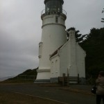
Heceta Head Lighthouse and State Park is a beautiful general recreation area located about 90 minutes outside Eugene and 15 minutes North of Florence. The area is known for it's beautiful views and primarily, Heceta Head Lighthouse. You have likely seen this area many times before in magazines, movies, and on TV. Fees: $3 for day use parking Location: 90 minutes West of Eugene. Take Highway 126 East to Florence and then 101 North to Heceta Head. Eugene to Heceta Head - Click Here for the Map Time Involved: I usually like to make a day … [Read more...]
Florence Sand Dunes
The Oregon Dunes offer numerous recreational opportunities for adventurers of all types. The dunes extend from Florence to Coos Bay along the Oregon Coast and were formed by the ancient forces of wind, water, and time. These dunes are the largest expanse of coastal sand dunes in North America. For more information please see the links below. Location: The dunes start just South of Florence, Oregon and extend all the way to Coos Bay. The Florence access points are about 70 minutes outside of Eugene on Highway 101. Eugene to … [Read more...]
North Umpqua River: Rafting, Kayaking, Hiking, Camping, Fishing
The North Umpqua River offers activities for all outdoor enthusiasts. These activities range from rafting and kayaking to hiking and biking. There are many great waterfalls to hike to and there are some great hotspings to soak in. The river is very clean, clear and refreshing. The North Umpqua River is nestled in the beautiful Umpqua National Forest. Location: Just east of Roseburg Oregon along highway 138, 1.5 hours from Eugene. Eugene to North Umpqua River - General Area - Click Here for the Map Time Involved: A trip here can range … [Read more...]
Alton Baker Park
Alton Baker Park is Eugene's largest developed park with over 400 acres to explore. The park features miles of running trails (paved and dirt), river paths, duck ponds, large open fields, a dog park, and an overall beautiful environment. Named after Register-Guard founder Alton F. Baker, the park is divided into two distinct areas: the more developed West Alton Baker Park and the natural and serene East Alton Baker Park. Location: North bank of the Willamette River smack dab in the middle of Eugene. Click Here for a Google Maps … [Read more...]
Trail Bridge Reservoir – Fishing, Camping, Hiking, Swimming
Trail Bridge Campground surrounds beautiful 120 acre man made reservoir located just over an hour outside of Eugene Oregon. The area around the reservoir is home to 46 camp sites, hiking trails, and some amazing fishing. During the summer, Trail Bridge is often full of campers and other outdoor enthusiasts looking to take in the scenery of the Oregon Cacades. Location: Trail Bridge is located just over an hour outside of Eugene and 13 miles east of McKenzie Bridge, OR on Highway 126. Eugene to Trail Bridge - Click Here for a Google … [Read more...]
Buford Recreation Area – Hiking, Scenic Viewing, Picnicking
The 2,363-acre Howard Buford Recreation Area (HBRA) is the largest of Lane County's 58 parks. The park is home to many activities, including hiking, picnicking, horse back riding, and general recreation use. The park's dominant physical feature is Mt. Pisgah, rising 1,531 feet above sea level or 1,000 feet above the Willamette River's Coast and Middle Forks, which flow around its base. From the summit, hikers and equestrians can enjoy expansive views in all directions except to the north. The HBRA is also home to the Mt. Pisgah Arboretum , and … [Read more...]
Clear Lake – Hiking, Fishing, Boating, Camping
Clear Lake is a crystal clear glacial spring fed lake located 90 minutes outside Eugene on highway 126. If was formed over 3,000 years ago when lava flows damned the McKenzie river and created the lake the see today. The lake itself is divided up into two sections, the North end and the South End. The water in the lake has a temperature of about 40 degrees farenheit year round. (COLD!) Location: Clear Lake is located approximately 90 minutes outside Eugene Oregon directly off of highway 126. Look for the sign for Clear Lake on the right … [Read more...]
Sahalie Falls
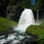
Sahalie Falls is a beautiful 140ft. waterfall located 75 minutes outside of Eugene on highway 126. The word Sahalie is a Chinook word meaning "high". These falls were formed 3,000 years ago when lava flows formed the McKenzie River. Location: Sahalie falls is located approximately 60 miles outside Eugene directly off highway 126. Google Maps - Eugene to Sahalie Falls - Click Here for the Map Adventure Specifics: The waterfall is easily accessible via a paved path from the parking lot. The are also numerous dirt and paved paths in the … [Read more...]
Hendricks Park
Hendricks Park is Eugene's oldest city park. Its 78 acres include a mature forest, a world-renowned rhododendron garden, and now a new native plant garden. Laced with trails, the park is a haven for hikers, birders, and others who enjoy retreating to the tranquility of nature. Without leaving the city, visitors can walk among Douglas fir trees two hundred years old, ferns, and wildflowers, such as trilliums and irises, and over six thousand varieties of rhododendrons and other ornamental plants. Location: Hendricks Park is located just south … [Read more...]
Cougar (Terwilliger) Hot Springs
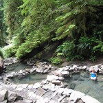
Cougar (Terwilliger) Hot Springs is located approximately 60 minutes outside of Eugene in the beautiful Willamette National Forest. The springs themselves consist of five tiered pools that become cooler as they flow away from the source. Recent improvements by Hoodoo Recreation has turned made the hot springs even better and cleaner than before. There is also a brand new covered shelter/changing area. Type: Natural Hot Springs Temperature: 112 Degrees in the upper pools to 85-90 Degrees in the lowest pool Hours: Day Use Only Fee: $6 Per … [Read more...]
